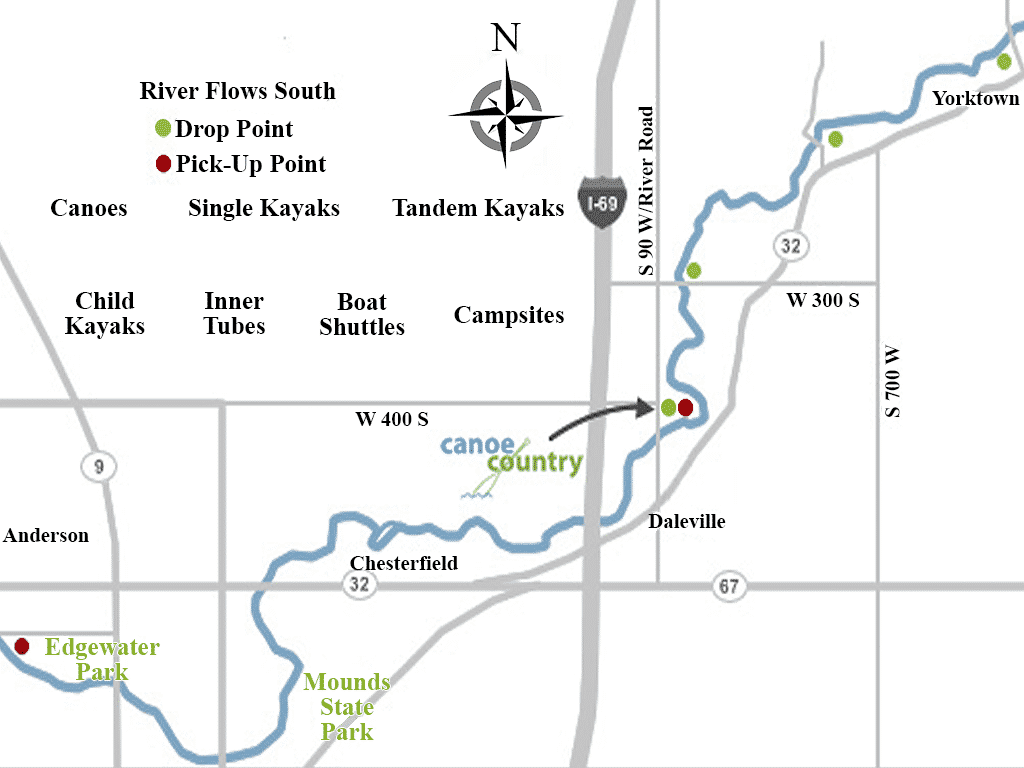
Trip #1: Approximately 2.5 miles (one hour) starting at High Banks Bridge and ending at Canoe Country in Daleville.
Trip #2: Approximately 5 miles (two hours) starting at Priest Ford Road and ending at Canoe Country in Daleville. Great for beginners and intermediates.
Trip #3: Approximately 7 miles (three hours) starting at Morrows Meadows Park in Yorktown and ending at Canoe Country in Daleville. Our most scenic trip.
Trip #4: Approximately 11 miles (four hours) starting at Canoe Country launch in Daleville. Travels through Timberline Ranch Campground, Mounds State Park and ends at Edgewater Park in Anderson. A great trip with many small rapids.
Trip #5: Approximately 17 miles (seven hours or take all day) starting at Yorktown and ending at Edgewater Park. (Combination of Trips 1,2,3 & 4)